Travel & Tourism

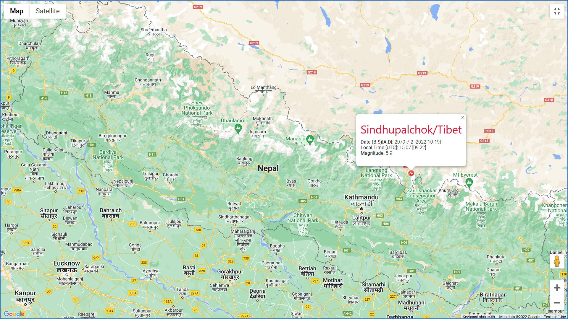
An earthquake of 5.9 ML jolted Kathmandu and surrounding areas in central and eastern Nepal on Wednesday at 3:07 pm local time.
The earthquake's epicenter was recorded near the Nepal-China border near Sindhupalchowk district, around 12km towards Chinese territory.
The National Earthquake Monitoring and Research Center (NEMRC) reported the coordinates of the event on its website as 28.15 latitudes and 86.06 longitudes.
The earthquake was accompanied by an aftershock at 3:53 pm local time, reported by the NEMRC. However small, the aftershock was 4.5 ML, with the epicentre near the same coordinate.
The United States Geological Survey, which tracks and reports earthquakes worldwide, reported the depth of Wednesday's 4.9 Magnitude tremor at 29.9 km.
The last major earthquake that Nepal experienced was measured at 4.8ML, with its epicentre at Banke on September 20.
Nepal lies in the boundary between the Indian and Eurasian tectonic plates, which is a seismically active zone. This tectonic collision develops immense pressure on the earth's crust below Nepal, which gets released as different earthquakes.
Nepal faced a devastating 7.6 ML earthquake in 2015, killing over 9,000 people and destroying nearly a million houses.


